Home ![]() News
News ![]() Spatial Plan: the immersive platform to digitalize site surveys and inspections
Spatial Plan: the immersive platform to digitalize site surveys and inspections
Spatial Plan: the immersive platform to digitalize site surveys and inspections

30/05/2025
dilium launches Spatial Plan and revolutionizes the world of real-time inspections
dilium launches Spatial Plan and revolutionizes the world of real-time inspections
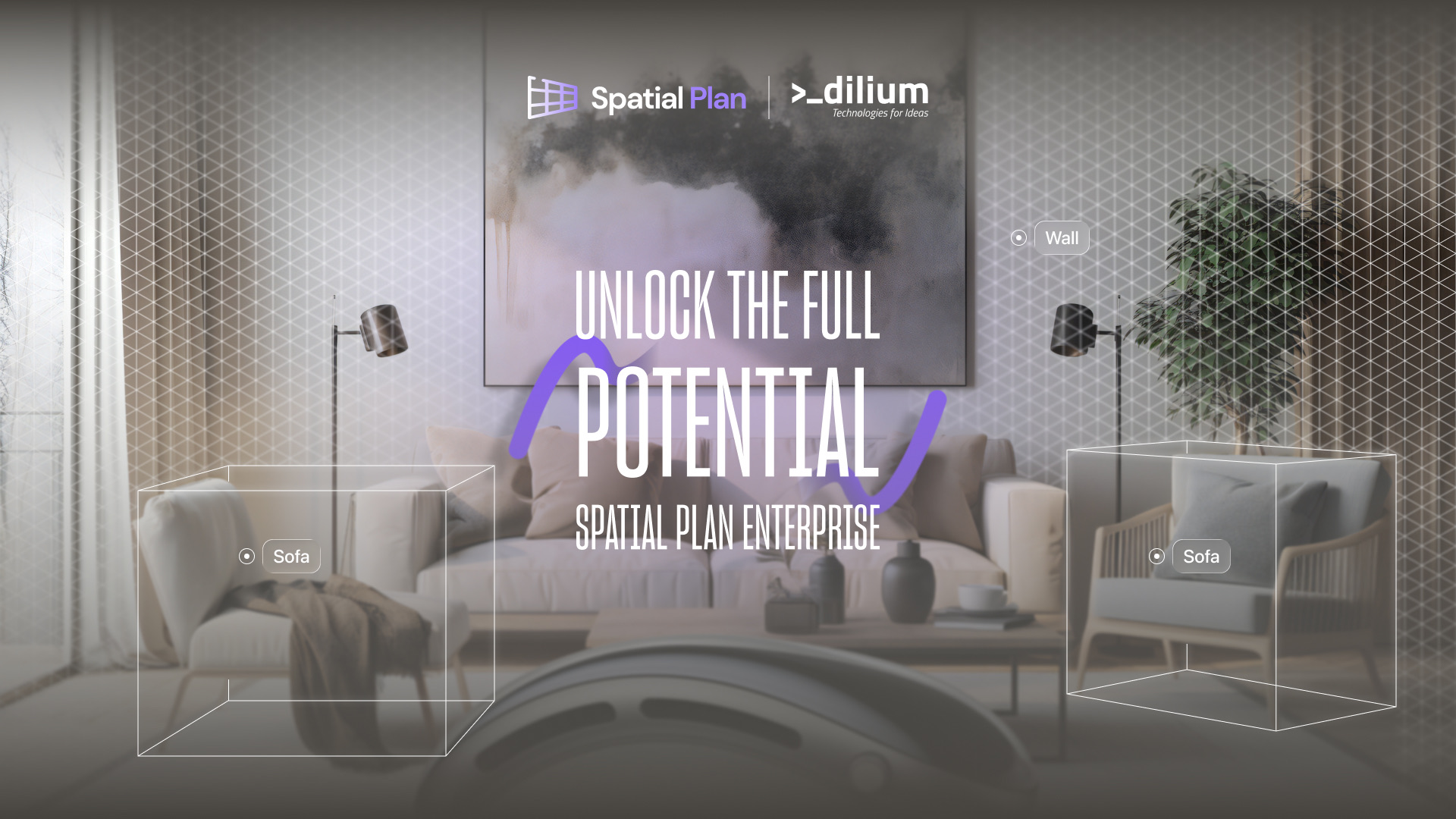
With Apple Vision Pro, inspections and site surveys become digital, immersive, and immediate thanks to the new platform developed by dilium.
Say goodbye to long timelines, fragmented data collection, and repeated site visits.
Today, at Palazzo Tursi in Genoa, Spatial Plan was officially presented — the new platform that is revolutionizing inspections in technical, industrial, and cultural fields.
Developed as part of the CTE Genova – Opificio Digitale per la Cultura program, Spatial Plan represents a paradigm shift for professionals involved in surveying, maintenance, and technical assessments.
With Apple Vision Pro, users can perform real-time scans of their surroundings.
The true game-changer lies in the platform’s features: visual annotations, voice memos, measurements, and technical comments can all be made directly on the 3D model during the inspection, minimizing errors, costs, and the need for repeat site visits.
“With Spatial Plan, we make inspections faster, more accurate, and fully digital, bringing real innovation to on-site processes.”
— Donato De Ieso, CEO of dilium
How Spatial Plan Works
- The environment is scanned in real time as the user moves through the space.
- With proprietary Spatial Drawing technology, users can highlight anomalies, insert technical annotations, record voice memos, and take measurements directly within the generated 3D scan.
- This approach reduces the need for repeat interventions, improving efficiency and accuracy from the first inspection.
Spatial Plan is not just a technological tool: it’s a platform designed to optimize time and costs, increase inspection accuracy, and digitally document every operation in a traceable way.
Cross-sector Applications
- Cultural heritage: Museums and institutions can document the conservation status of artworks and historical environments with detailed scans for more targeted interventions.
- Traffic and road safety: Quick 3D capture of accident scenes simplifies technical evaluations and reduces response times.
- Plant and infrastructure maintenance: A field-ready tool for immediate inspections and direct annotations on the model.
- Insurance and appraisal: A precise visual base for evaluations and audits, reducing the need for physical visits.
An Innovation-Driven Project
Spatial Plan was developed as part of the Tech Up – CTE Genova – Opificio Digitale per la Cultura program, with support from PSC MISE 2014–2020 (CUP B37F23000000008).